Saturday, May 21, 2011

Departing the Trace and Visiting Jack Daniel's Distillery


This entry is for Saturday, 21 May 2011:
Paul commented today that he thought we were a little light visiting Dairy Queens on this trip. We agree and decided to do something about it as you can see in the first photo.
Today's ride was 375 miles in total. We finished riding the Natchez Trace in the morning taking it from Tupelo to Route 412 in Gordonsburg. This point of departure was about 13o miles north of Tupelo but about 52 miles before its end point near Nashville. The stops we made today on the trace were a bust in that there was nothing really to see. For example, we stopped at the Napier Open Pit Mine stop and found a hole in the ground with large trees growing withing...not much to see. We departed at Rt. 412 to make a loop to the south and east to go to the Jack Daniel's Distillery located in Lynchburg, TN. After the JDD tour, we looped back up to the north and west on different secondary routes to end up in Clarksville, TN adjacent to the Cumberland River for the night. Clarksville is located to the north and west of Nashville.
Highlights for the day included the following:
The Jack Daniel's Distillery tour. See photos of facility and Gerry and I at Jack's statue.
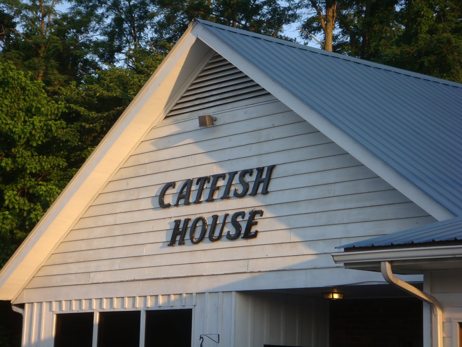
Enjoyed local cuisine at both lunch and dinner today. Had lunch at Stan's Restaurant in Columbia, TN on route to the distillery. Enjoyed a great grilled chicken (southern style) salad with my favorite red french dressing. This was followed by some outstanding home made banana pudding. Dinner was at the Catfish House in Clarksville. Had the combo of grilled catfish and fried shrimp. Very good. Finished this off with a stop at DQ as noted above.
Tomorrow's ride will take us over the "Trace Road" that goes through the Land Between the Lakes National Recreation Area located a short distance west and north of Clarksville. Thereafter, we plan to visit the Maker's Mark Distillery in Loretto, TN.

Friday, May 20, 2011

Riding the Natchez Trace to Tupelo


This entry is for Friday, 20 May 2011:
Today's ride was over about 285 miles of the Natchez Trace. This was an easy and relaxing ride compared to some of the previous days. Temps were in the 60s and it was overcast in the AM getting up into the high 80s and sunny in the PM with high humidity throughout the day. We did get a few sprinkles in the AM but not enough to require rain gear.
The original Natchez Trace was the pathway the "Kaintucks" used to return home to the Ohio and Mississippi River valleys after transporting their goods to market in Natchez or New Orleans via flat bottom boats in the early 1800s. Their goods included agricultural products, coal, and livestock to name a few.During this time and way prior to that Native Americans from the Choctaw and Chickasaw Tribes occupied the land adjacent to the trace.
Today, the Natchez Trace is a 444-mile paved parkway that extends from Natchez, MS to just south of Nashville, TN. Today's trace follows portions of the original trace pathway. This parkway is under the management of the National Parks Service and has numerous historical markers/points of interest and other points of interest marked along the parkway. I have posted a few photos of some stops we made today. They include:
Emerald Mound - 2nd largest Native American burial mound in the US
Buried Trace - section of the original trace
Cypress Swamp
Dean Stand Site - served as inn for travelers from 1820 - 1830s
The ride itself today was easy and relaxing. The speed limit is 50 mph and there is very little traffic along the parkway and no commercial vehicles are allowed. Riding the trace is like riding over a private road through the woods. The trace is tree-lined and frequently has a tree canopy as you can see in the posted photos.
We encountered two sections along the trace that were clearly hit by recent tornadoes. Many trees have been uprooted and/or had their tops sheared off in the wind. This occurred over about 15 - 2o miles of the parkway, located about 60 miles south of Tupelo.
Tomorrow, we will do more of the trace to the north before departing it to venture into Tennessee tomorrow.

Thursday, May 19, 2011

Across Bayou Country to the Mighty Mississippi


This entry of for Thursday, 19 May 2011:
Today's ride took us 380 miles across the state of Louisiana from Shreveport, LA to Natchez, MS at the Mississippi River. The plan was to follow the Red River to the southeast from I-20 and then generally west on Rt. 84 all the way to Natchez. Passing through through Kisatchie National Forest on Rt. 84 reminded me of riding in Vermont and western Massachusetts (i.e., single lane roads, trees on both sides and rolling hills). Over the course of the day we saw farm land, bayous, rivers, forests and Mississippi River plain farmland with corn and wheat crops.
We added three loops to the basic route to allow us to see some back areas in LA and what is going on with river flooding first hand at Vicksburg and Natchez, MS.
The first loop took us to the Russell B. Long Lock & Dam on the Red River. This river was not experiencing flooding conditions (see photo).
The second loop took us off Rt. 84 at the Town of Whitehall to the northeast to Rt. 20. We took I-20 to get us into Vicksburg. Along this route we needed fuel at the Town of Winnsboro, LA, stopping at what seemed like a normal convenience mart-type gas station. Were we ever wrong. This place was also "Big Boy's Bar-B-Que" so we decided to have lunch at this stop. The pulled pork barbecue and baked beans were "out of this world." The local people, curious about our peculiar accents, were very friendly and helpful...a memorable lunch for sure. During this lunch conversation we were coached on the proper "local" pronunciation of Natchez (rimes with matches).
Because of tarface23's comment about drive-thru daiquiri establishments in Louisiana, I was on the look out for one all day. Saw one sign for a Daiquiri Shack but never encountered it on the routes taken. I did see two more drive-thru packies but it was not at the end of the ride and we did not stop today for any refreshments. I saw the opposite of a Road Runner today crossing the road...a 12-inch black turtle. No, I did not run over it.
Record river levels were indeed being experienced and we saw first hand conditions at Vicksburg, MS today. The photos posted show the situation. Low areas adjacent to river were flooded and the river level was almost at the bridge approach deck level for the I-20/Rt. 80 bridge on the LA side. Most of the city of Vicksburg sits on a hill so was not impacted by the river flooding. However, the Yazoo & Mississippi Railroad Station close to the river at Vicksburg was inundated as you can see in the posted photo.
After Vicksburg, we went back over the Mississippi River on the I-20 bridge and took Rt. 65 south with the intent to get us back to Rt. 84 to take us into Natchez, MS. We took another detour loop in the area of Newellton, LA that let us see a Mississippi River backwater area. I posted a shot of the backwater area that we stopped at.
After the backwater loop we got back on Rt. 65 south to Rt. 84 and crossed the Mississippi River for the third time going into Natchez. The river level at the levee on the LA side, downstream of the Rt. 84 bridge, had very little to go to be overtopped. There could be some levee failures tomorrow as the cresting level at Natchez is expected to be a record tomorrow. We hope to be long gone up the Natchez Trace by the time peak river levels arrive. I posted two photos of conditions today at the Rt. 84 bridge at Natchez, one showing the LA side levee and the other showing the bridge itself as the sun was going down.
Tomorrow, we are heading to the northeast from Natchez on the Natchez Trace with an intended destination of Tupelo, MS. The Natchez Trace is a 440-mile road of historical significance that goes almost all the way to Nashville, TN. Check it out by Googling "Natchez Trace."

Wednesday, May 18, 2011

From Texas Wind Farms to the Bayou


This entry is for Wednesday, 18 May 2011:
Wow! Texas is really big when you ride across it east to west! It took us two days to finally reach the Louisiana border.
Anyway, today's ride was about 440 miles of relatively straight and flat highway riding that included some interstate. Leaving Snyder in the morning we passed two wind farms that were utilizing the considerable wind that we were encountering in our face as we road along Rt. 180. The first farm had about 100 turbines and the second one more like about 50. The photo shows how the wind farms have been integrated with the farming that was going on all around the farms. As we progressed further east, the landscape generally got greener with more hills and the vegetation became more dense and with increasing heights...becoming trees as we approached Fort Worth, TX and beyond as shown in the photos. In the early part of the trip, I had a Road Runner scoot across the road right in front of me...that was a first for me. It was way too fast for me to get a photo of it. We went through many small Texas towns along Routes 180 and 80. It gave us a chance to see how and where the real people of Texas live and we occasionally got to see some interesting public building architecture (see photo).
We took a slight detour from our planned route to have lunch with Gerry's daughter and two grandchildren near the TCU campus in Fort Worth. Then we got back on route and schedule by doing two sections on I-20 that runs more or less parallel to 180 and then Rt. 80.
We decided to push the ride beyond Texas into Louisiana so that we could spend the night in Shreveport, a.k.a bayou country. We stayed in downtown Shreveport and for dinner ate local cuisine at Ralph and Kacoo's based on hotel staff recommendation. I had the Crawfish Festival meal which provided a sampling of various crawfish dishes. As they say...when in Rome, do as the Romans do. Good crawfish...I like!
Tomorrow we are headed to Natchez, MS which is at the start of the Natchez Trace. The Natchez Trace is the historic route we plan to ride on Friday and Saturday. There is much history that is associated with the Natchez Trace and we plan to make some stops and learn a little about it on this trip.

Tuesday, May 17, 2011

After a long day riding...


This entry is for Tuesday, 17 May 2011:
After completing today's adventure and ride and 385 mile ride from El Paso, TX to Snyder, TX, Gerry and I decided to have dinner and a little refreshment, Texas style. We had a steak dinner at Skeet's (which no doubt stands for Skeeter) and stopped into the local Texas drive-thru packy (see photos). What hoot to drive in and out with Bud Lights for the night. This was a first for me but probably not the last while in Texas.
The adventure of day was a visit to Carlsbad Caverns National Park in southeastern New Mexico. This was a fun experience doing some modern spelunking into the caverns via a steep paved footpath to a depth of 750 feet below ground surface. This walk was tough on the knees but well worth the effort and recommended for those fit enough to make the journey. We spent over 2 hours underground. I have posted a few shots of the caverns and the entrance road area which was beautiful as well.
The rest of the ride was, let's say, not great as we went through long desolate sections of eastern New Mexico and western Texas. The terrain was very flat and dry, conditions were sporadically windy and sporadically dusty. The road was mostly straight. However, on the bright side, we did not encounter any cattle guards the entire day. We probably went over a 100 of those things oer the previous few days.
The exception to this was going through the Guadalupe Mountains where the terrain was great, the road had some curves, but it came along with some strong cross winds (see photo).
Tomorrow, we are heading further east along Rt. 180 to a point east of Dallas/Fort Worth. The plan says we will stop at Mineola, TX but since we went about 60 miles further east today, I expect we will go beyond Mineola to close to the Louisiana border.

Monday, May 16, 2011

Yes...another great day of riding


This entry is for Monday, 16 May 2011:
Today's ride took us from Silver City, NM to El Paso, TX, a total of about 390 miles. The ride included about 70 miles of mountain riding to start heading east on Rt. 152 from Silver City over the Emory Pass at elevation 8228. Lot of grade changes with many turns, twisties and switchbacks to Caballo, NM (see photos).
Then we headed south to Las Cruces through the Rio Grande River valley along Rt. 187/185. This section of the ride was through farmland with lots of pecan tree groves and several green chili companies (see photo).
From Las Cruces we headed east across the White Sands Missile Range to Alamogordo, NM, about 60 miles of hot and windy desert riding. We stopped at the White Sands National Monument which is located about 10 miles west of Alamogordo. This national monument includes extensive sand dunes which are the whitest sand I have ever seen (see photos).
After the national monument stop we headed up into the Sacremento Mountains and did a loop that started and finished back in Alamogordo. Interesting terrain and tunnel getting up into the mountains (see photo). Saw two groups of 5 to 7 deer grazing in alpine meadows on this loop.
The final section of the route was about 90 - 100 miles of flat, straight, hot and windy desert riding south into El Paso. We couldn't resist the opportunity to visit Barnett's Harley-Davidson, reportedly the World's Largest Harley Dealer. It was definitely a big dealership but it seemed like most of the bikes in the inventory were used. Construction was underway and gypsum dust from drywalling was all over the merchandise.
Thanks to Gerry having a free night at a Marriott, we are living it up on the Concierge Level in the El Paso Marriott. Can't beat the price!!!
Tomorrow by plan we are headed further east to Lamesa, TX along Rt. 180. We plan to stop at the Carlsbad Caverns National Park along the way...should be interesting.

Sunday, May 15, 2011

Petrified Forest National Park and Mountain Ride


The entry is for Sunday, 15 May:
Today's ride took Gerry and I from Holbrook, AZ to Silver City, NM, approximately 345 miles. After a short section of I-40 east from Holbrook, we visited the Petrified Forest National Park. The northern section of the park is adjacent to the Painted Desert which was colorful in the morning sun as you can see in the photos posted. The southern section of the park, south of I-40 is the Petrified Forest part of the park. I have posted a few photos of petrified trees in the Blue Mesa and Crystal Forest sections of the park. The park itself includes about 25 miles of roads that take you from scenic spot to scenic spot. We entered the park on the north side and exited to the south at Rt. 180.
Whenever I visit a national park I am reminded how important it is to designate and preserve park land. We are very fortunate in this country to have so many beautiful national parks . Visiting them all is definitely on my "bucket list."
After the national park visit, we headed south and east on Rt. 180 to Alpine, AZ where we stopped for lunch and fuel. From Alpine it was up into the mountains along Rt. 191 which is known as the Coronado Trail. This part of the ride was about 100 miles of challenging mountain roads comprised in the first section about 60 miles of mountain sweepers followed by 40 miles of twisties and switch backs that included large elevation changes in short distances of road. Thankfully, there was very little traffic on this road which made the ride more enjoyable and safe. We went over Rose Peak at elevation 8766 and stopped to take a photo of the mountain vista which I have posted.
In the latter part of the mountain ride we passed by the Phelps-Dodge Morenci open pit copper mine. This is one huge hole in the ground as you can see in the posted photo. What a contrast to the photos of the untouched terrain proved by mother nature.
After the mountain section of the ride, we headed east on Rt. 78 to connect up with Rt. 180 again in NM. From this point, Rt. 180 took us all the way to Silver City, NM.
I forgoet to mention in my earlier posts that I drank my own Kool Aid from last year's reflection on the trip and installed a plug-and-play satellite radio on my bike. It works great. I have great music to my liking all the time in all locations, including Tecopa Hot Springs, CA where there are no typical communcation services. A different way of life for sure.